
“The sea is everything”. Pierre Aronnax’s words in Twenty Thousand Leagues Under the Seas, a book by Jules Verne. More than 150 years have passed since they were first written – and they have not lost their meaning. Verne’s futuristic visions have inspired generations of explorers and scientists, including Jacques Cousteau, an oceanographer born in 1910. Verne brought the magic of the sea to our imagination and Cousteau turned the dream into reality, breaking boundaries with Aqua-Lung, the first scuba diving equipment, or Calypso, a floating laboratory equipped with advanced technologies like sonars or cameras, which allowed the research and detailed documentation of marine life.
Let’s sail to 2024. From underwater robots (ROVs[1] and AUVs[2]) to observation and monitoring technologies, INESC TEC has played a vital role in this area, reinforced by strategic partnerships and the participation in multiple international projects. We know that our cutting-edge research and technologies have contributed to deepening ocean exploration on several missions – from the Arctic to Brazil. But how do our robots navigate underwater? We are also able to detect seismic activity through distributed acoustic sensing. How does this technological innovation work?
Better than Professor Aronnax or Captain Nemo, our researchers have all the answers. Ready to dive into this adventure?
Did you know that we have fibre optics scattered all over the ocean?
If you don’t believe me, Google it! Fibre optic cables on the seabed form the backbone of the global internet and are crucial elements to underwater research. In addition, fibre optic technology is the basis of several INESC TEC research activities in acoustic measurement and sensing. Yes, you read that right; optical fibre is not just for data transmission. The first steps were taken by the researcher Susana Silva, through her PhD thesis on the use of optical fibre to measure the refractive index and gas detection at a distance of 10 kilometres (leading to a patent). Today, we have covered more than a dozen kilometres, and we work with distributed acoustic sensing (DAS).
“There are thousands of miles of fibre optics installed around the world. Concerning our projects related to the use of underwater fibre optic cables, we use the fibre itself as a sensor to make acoustic measurements, namely in terms of seismology. We continuously transmit data as light pulses along the optical fibre; due to the intrinsic flaws of said fibre, part of said pulses are reflected, i.e., they travel backwards. When an event occurs, the optical fibre detects propagated mechanical waves, generating a local disturbance and, consequently, the variation of the light reflection. Retro-reflective impulses carry relevant information about ongoing events. This data tells us that – at a certain place and time – something was detected, and we must identify it”, explained the researcher.
But how do we know that a reflection of light corresponds to seismic activity? We need to consider the disturbances inherent to a cable coming from the ground, e.g., the movement of streets, cars and even waves. Orlando Frazão, INESC TEC researcher dedicated to photonics, simplified this aspect: “let’s consider the cable that departs from the landing station in Madeira (~50 km long) – used exclusively for scientific and research purposes. As we were able to locate the position of the cable, we were capable of visually identify the changes corresponding to a car driving by (because we know that there’s a road there) or to waves crashing on shore (since that’s the spot where the cable enters the sea). We carry out an analysis in partnership with professionals from different areas, e.g., geophysicists or biologists, because we also collect the sounds of whales, sperm whales or dolphins – all species with different frequencies. The Portuguese Navy also plays an important role in helping us identify ships travelling at a certain time and place”.

When these researchers first detected long-distance seismic activity on Madeira Island, it wasn’t exactly an easy job. “We detect earthquakes – local or in the middle of the Atlantic – every week. We have already detected earthquakes in China and Turkey. But our goal is to detect the places where earthquakes occur – especially those with a magnitude below 2.5 on the Richter scale. The benefits? If we start to detect the periodicity of earthquakes, even if small, we can predict the occurrence of a major earthquake”, added Susana Silva. INESC TEC is helping to create a future where we’ll be able to predict seismic activity with greater accuracy. Avoiding catastrophes is the target – but the road ahead is long. “When we receive the data, through DAS, we must process it; this is a time-consuming task that requires highly specialised senior technical staff. Currently, data analysis takes too long to emit an early warning. Therefore, computing resources must be powerful and carry out high-performance operations to enable data processing quickly and efficiently – combined with the storage capacity of petabytes[3] of data. It’s worth mentioning that, depending on the operational parameters of the DAS (namely sampling frequency and resolution), one can collect terabytes of data per day. We must wait for the development of quantum computers to boost the development of early warning systems associated with the analysis of large amounts of data”.
Orlando Frazão perceives DAS technology as an opportunity: we cannot prevent a tsunami, but manage collateral damage, like fires (similar to what happened in the Lisbon earthquake in 1755), with a previous power cut. As part of the MODAS project, researchers are monitoring the underwater cable in the Azores (between the islands of Faial and Flores) through DAS technology and mete-oceanographic buoys, a standard technique for monitoring various parameters like temperature, salinity, pH, tides, etc. The combination of both technologies will allow the collection and comparison of seismology data.
From Portugal to the world, from the sea to the land: DAS without borders?
The European project SUBMERSE (bringing together 24 partners, including INESC TEC) aims to install DAS units in three different locations – Norway, Greece and Portugal – to monitor underwater cables. The goal is to connect said locations through a platform (under development) that provides access to real-time data. Hence, we’re taking monitoring to a new level, with the installation of equipment and storage of a huge volume of data – with security implications regarding free access. “It is an ambitious and very complex project. Norway, for example, provides little data and is always very well filtered. Why? Because, due to its geographical location, DAS can detect data that the Government or National Security have no interest in disclosing, like the movement of military vessels. We must address certain security issues very carefully, since we will have access to potentially sensitive information”, said Susana.
From sea to land: acoustic sensing technology has already been tested on the railroad. “In addition to underwater cables, there are land cables that connect the northern and southern regions of the country. Concerning railroad, this monitoring can be of great interest in terms of repairs, but also to identify stops and breakdowns – or even other types of disturbances like copper theft. In other words, it can play a very important role in railroad prevention and monitoring”, explained Orlando Frazão. But we won’t stop there! In the Extra High Voltage (EHV) lines of the Rede Elétrica Nacional (REN), guard cables with built-in optical fibre (Optical Ground Wire) play a crucial role in protecting and monitoring the power grid. Through DAS technology, they can detect electromagnetic discharges, the integrity of the spans and even when birds collide against the EHV. The impact on bird populations may be relevant – particularly in the case of rare and endangered species. “Orlando identified this as an excellent opportunity to integrate the technology, allowing the spatial and temporal detection – with greater accuracy – of the birds that collide against the lines. Currently, the method is 100% human: there are visual prospecting areas to identify bird corpses under the lines; however, it does not correspond to the real mortality ratio among birds caused by collisions, since some of them are taken by predators, for instance”, mentioned Susana Silva.
As large as necessary, as small as possible
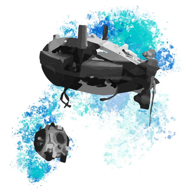
When we talk about deep-sea research, we must not forget robotics; at INESC TEC, we challenge ourselves daily, to turn our robots into vital tools. In other words, we may not focus on discovering new coral species… but our robots can play a part in this process! Nuno Cruz, INESC TEC researcher in the field of underwater robotics, told us that developing certain tools or features doesn’t always require end-users. “We are not limited to technological developments established during the earlier stages of project design. For example, a water sampling system can be used to account for sediment carried by river waters or to collect vital information to biologists. The same technology, applied to different contexts”.
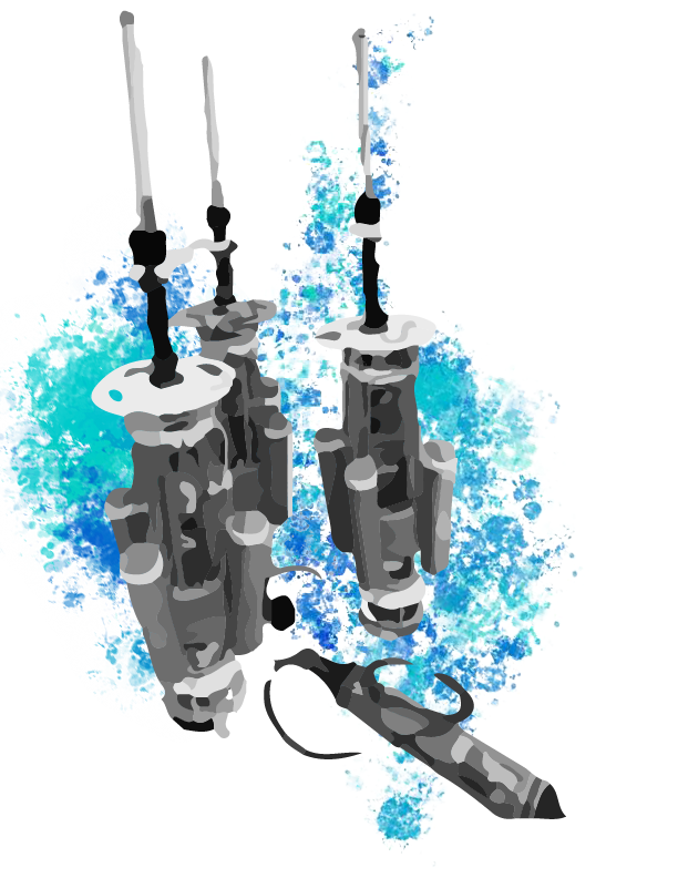
This may explain why we have so many robots… and other resources! In addition to autonomous vehicles, we also developed robotic systems that only collect data, as well as technologies e.g., location system that can be used on robots or independently. We have robots big and small. With or without cables. With greater or lesser autonomy. And with different sensors and objectives. Are you still with us?
“Most vehicles can be operated with cable, which represents advantages in terms of power supply and responsiveness, since we’re connected to the robot in real time, with immediate access to collected data. In addition, it represents greater safety: we will hardly lose our robot. The disadvantages? No one is going to travel for longer distances with a harnessed cable; also, in cave missions, cables pose a danger, as they are likely to get stuck. Small vehicles are lighter and easier to operate, requiring only a small support boat, but limited in the ability to carry sensors or power on board – mainly through batteries. So, what is the best solution? It depends on the objective!”, stated Nuno Cruz.
Scenario: travelling along the coast, for 100 kilometres, to study a parameter like water pollution. We need a hydrodynamic solution: a torpedo (larger water resistance and reduced power required to operate) could be a good solution. But what if the goal is more than knowing the extent of pollution? What if researchers need to measure specific elements? “The torpedoes are designed to travel in the same direction, with little manoeuvrability – which is why they are almost never used in inspecting processes. But if the priority is efficient movement, then the ideal scenario is to equip our torpedo with the best sensors available – camera or turbidity sensor –, given the little space we have. I would say we want our robots as large as necessary, as small as possible”.
At sea, there is no GPS or roads: how do we navigate underwater?
If you are a fan of James Cameron and have seen the movie The Abyss, then you should know the term “sonar”. At INESC TEC, we are yet to recover a lost nuclear submarine… but we use this technology to support our robots’ navigation and location. “When we talk about location, there are two issues: the robot itself must know where it is, and we, on the surface, must know it too. For self-location, we use sonars: autonomous equipment that measure distances – quite like bats, who emit sounds and wait for the echo. Then, they convert the time it takes for the sound to go back and forth into distance. After that, the robot sends a signal to a buoy to know where it is, before following a specific trajectory underwater. And on the surface, we do something similar: we emit a signal that provides us the location of the robot, in relative terms”. If all devices are synchronised, all you need to do is to define which ones send and which ones receive signals; then, you no longer need to wait for the echo of the sound emitted, thanks to trilateration. And if you think that this acoustic location technology is limited to robots… you’re wrong. “On a mission to Brazil, we used a set of buoys equipped with GPS and a cylinder with an emitter placed on the back of the diver. We set up a system that allowed not only to follow the evolution of the diver, but also to send a special signal, previously coded, when the diver found something relevant – without the need to come to the surface, as happened in the past. And this is revolutionary. In this case, we used technology to map corals, but it could be used for anything else”, said Nuno Cruz.
There are other ways to get the location of a robot. We know that it takes about one second for the sound to travel 1500 meters underwater. But this is an estimated value, and the average speed of sound may vary depending on location and conditions. “In Porto, the sound does not propagate as in Lisbon. Sound propagation on surface and on the seabed is quite different. Why? We must consider aspects like salinity, conductivity, and water temperature – that can vary locally and throughout the day. Also: sound does not propagate in a straight line”, explained the researcher.
Thus, we use additional sensors like compasses, CTD (Conductivity, Temperature and Depth) sensors that record conductivity, temperature and pressure or DVL (Doppler Velocity Log) sensors that measure the distance to the seabed, the speed of the vehicle, and the water column. One thing’s for sure: the greater the freedom of our vehicles, the more difficult the location, as there are no predefined routes; the more values we can collect, the easier it will be to make a complete profile.
Autonomy and efficiency: the new paradigm of underwater robotics
A few years ago, no one wanted to venture to navigate with robots near seaports; but as we evolved and gained confidence in navigation, we started to use obstacles as a reference to guide us. But this is just the tip of the iceberg of what we can still do when it comes to underwater research. According to Nuno Cruz, we are facing a new paradigm: more efficient robots with the ability to interpret and filter data. “The future involves developing robotic solutions with greater autonomy. Autonomy in the sense of going further and spending more time underwater, using less battery; in terms of the ability to make decisions, operating without supervision. We want robots capable of detecting, interpreting and sending synthesised information. We want to work in more risky and complex scenarios, like shipwrecks. We want to use water vehicles capable of charging batteries at docking stations underwater, something we are already studying with the K2Dproject“.
Modern sonar technologies, distributed acoustic sensing, and underwater robots are a natural evolution of Cousteau’s legacy; plus, the European Commission already recognises INESC TEC as a credible entity at the forefront of research in these areas. Susana Silva, Orlando Frazão and Nuno Cruz: at INES TEC we have more than one Captain Nemo[4] to guide us towards the future.
[1] Vehicles operated remotely, and controlled from a station on the surface, via cable.
[2] Autonomous underwater vehicles, which do not require a human operator.
[3] One petabyte corresponds to 1024 terabytes.
[4] Fictional character, from the novels of Jules Verne, who drove the submarine Nautilus – having made important scientific discoveries on the seabed.
 News, current topics, curiosities and so much more about INESC TEC and its community!