
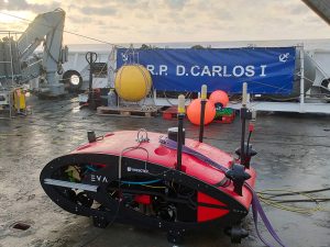
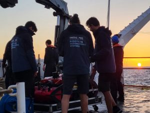
In October, INESC TEC researchers contributed to a new data collection and mapping campaign of the Madeira–Tore geological complex. With the support of the autonomous vehicle EVA, it was possible to collect data and images of the seabed at depths of up to 1,100 metres.
The mission was carried out on behalf of the Portuguese Institute for Sea and Atmosphere (IPMA), in close liaison with the Navy’s Hydrographic Institute (IH) and the Faculty of Sciences of the University of Lisbon (FCUL). On board the NRP D. Carlos I (a vessel of the Portuguese Navy), the INESC TEC team departed from the naval base in Almada on 10 October, heading towards the Madeira archipelago.
During the first three days of the campaign, operational maintenance was carried out on the IbMa-CSV oceanographic observation station, part of the Iberian Margin node of EMSO-ERIC (European Multidisciplinary Seafloor and Water Column Observatory – European Research Infrastructure). The structure is installed southwest of Cape St Vincent, off the coast of mainland Portugal. According to the Portuguese Navy, this operation included “the recovery and redeployment of scientific equipment and the collection of profiles and samples from the water column”.
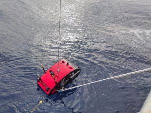
The mission then continued towards the Madeira–Tore seamounts – more specifically, the Ampere Bank and Coral Patch. The objective was the “collection of detailed data from the ocean floor through bathymetry and image acquisition”, explained Carlos Almeida.
The INESC TEC researcher stated that, “using the autonomous vehicle EVA, it was possible to collect high-resolution images as well as a three-dimensional map of the seabed using multibeam sonar”. “The surveys were conducted at depths between 600 and 1,100 metres, deployed from the NRP D. Carlos I, a Portuguese Navy vessel”.
According to Carlos Almeida, this type of work is “crucial for understanding vulnerable marine ecosystems”. However, “conventional techniques face significant challenges”. With remotely operated vehicles (ROVs), “the umbilical cable connecting them to the support vessel limits their autonomy and the area they can cover on the seabed”.
In the case of towed systems (Towed Cams), “the ability to maintain a constant and optimal distance from the seabed is affected by vessel motion and currents, compromising the quality of the images and high-frequency sonar data”. In addition, “difficulties in managing altitude increase the risk of collision with seabed obstacles”.
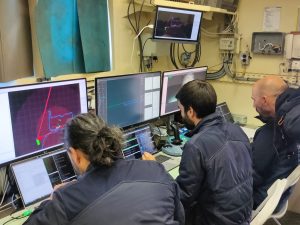
This is where the AUV (Autonomous Underwater Vehicle) EVA comes into play, as it is capable of “mitigating these disadvantages and mapping large areas with high resolution”. “EVA is equipped with a highly precise navigation and control system that allows it to operate on the ocean floor for extended periods while always knowing the vehicle’s exact position.”
Carlos Almeida highlighted the pros of using EVA in this type of campaign, noting that it “can ‘fly’ at low altitude in a stable manner, maximising the effectiveness of high-frequency acoustic and optical sensors, which require close proximity to achieve maximum detail”. “For all these reasons, EVA can efficiently cover large areas, reducing the operational costs of the surface vessel.”
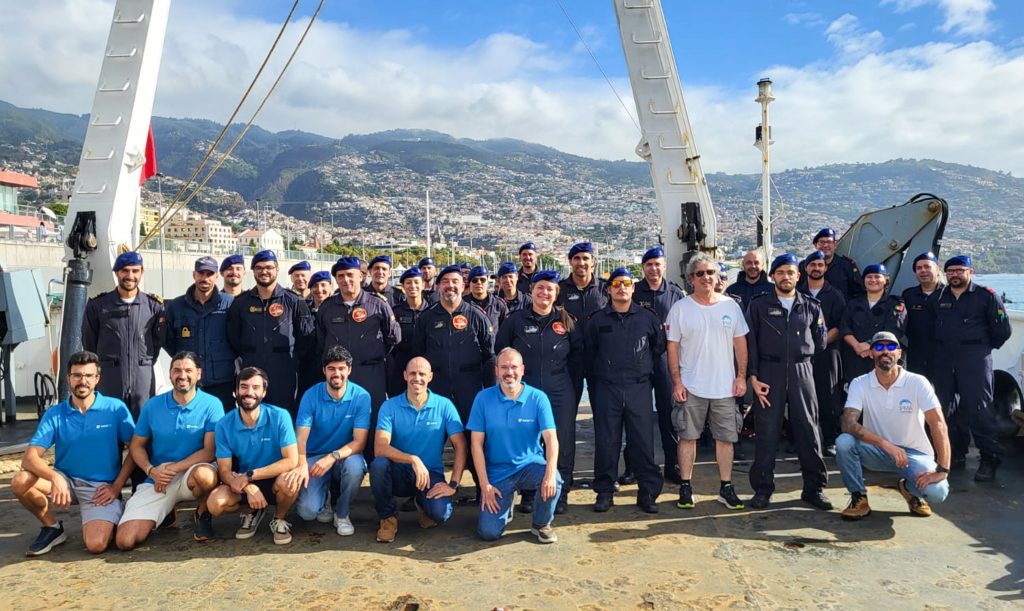
As part of the Global Drifter programme, three observation buoys were also deployed to collect data on ocean currents, as well as samples from the water column and phytoplankton. The mission concluded on 18 October in Funchal.
The researcher mentioned in this news piece is associated with INESC TEC.
 News, current topics, curiosities and so much more about INESC TEC and its community!