A team of researchers from the Institute for Systems and Computer Engineering, Technology and Science (INESC TEC) set the record for exploration of the world’s deepest natural cave, the “Hranice Abyss” (Czech Republic), by sending an autonomous underwater vehicle up to 450 metres. The UX-1Neo is one of the most technologically evolved underwater robots in the world, and it was developed by INESC TEC, within the scope of the UNEXUP project.
After years of research and numerous exploration missions in the “Hranice Abyss” (Czech Republic), INESC TEC researchers Alfredo Martins, Carlos Almeida, Eduardo Soares, Pedro André Peixoto and Ricardo Pereira joined a new expedition in early August, towards exploring the deepest flooded natural cave in the world, while making its 3D map and collecting water-related data.
Alfredo Martins, who is also a professor at the Porto School of Engineering (ISEP), stated that “the cave, which we believe reaches more than 900 meters deep, has been explored by divers, who reached close to 200 meters”. The latest mission took place within the scope of the UNEXUP project – and, for the first time, it was possible to “successfully explore the cave up to 450 meters and obtain a detailed map, something that was not possible before”, mentioned the researcher.
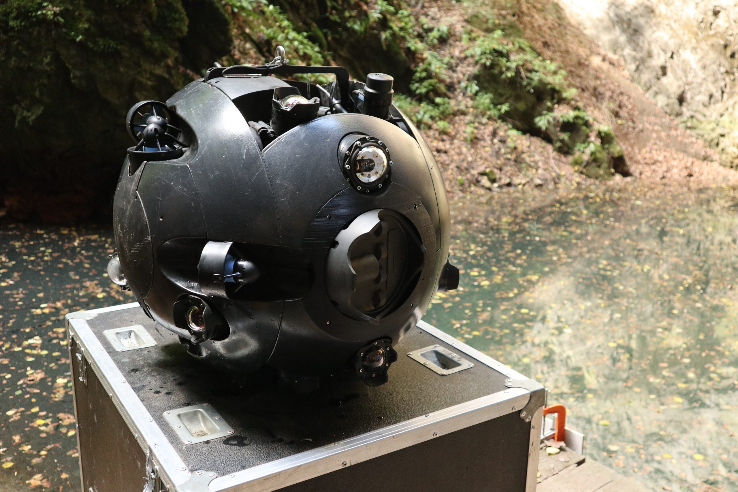
The UX-1Neo, developed by INESC TEC, is one of the most technologically evolved underwater robots in the world. As an Autonomous Underwater Vehicle (AUV), it carries out exploration missions in a completely autonomous way and with precise positioning, unique features that can be used depending on the mission or risk factors. In particular, the robot combines the data from a multi-beam sonar, with two rotating scanning sonars, six cameras and six 3D structured light reconstruction systems – which allow to design thorough 3D maps. Thanks to this technology, the robot was able to map “after two days of diving missions, what has been explored over the past 50 years”, claimed one of the divers who participated in the expedition.
According to Alfredo Martins, the previous maps of the cave were created according to information provided by divers (up to 180 meters), and later thanks to information provided by a diver who was able to reach 217 meters and two acoustic probes that were dropped via a cable, until reaching 384 meters. The previous record was set in 2016, through a remotely operated underwater robot, which reached 404 meters, on a National Geographic expedition.
This feat was achieved by a remotely operated vehicle (ROV), “without any positioning/navigation system, so it could only be piloted by a very experienced operator, according to the images transmitted by the robot”, explained Alfredo Martins. The difference for UX-1Neo is that the latter is an AUV with the ability to perform missions autonomously and without cable.
The exploration mission was organised by the Czech Speleological Society, featuring the UNEXUP project consortium. This project aims to implement a new mine-mapping service, based on a new class of autonomous underwater robots capable of exploring up to a thousand meters deep, obtaining relevant data like the structural state and performing mapping processes (allowing to know if there were landslides or other issues); they can also collect important geological data to determine the existence of mineral resources with economic interest, which would otherwise be more difficult and dangerous to obtain, leading to higher costs.
UNEXUP is funded by EIT Raw Materials at around €2.9M. It ends in December 2022 and, in addition to INESC TEC, includes the following partners: University of Miskolc (leader) and UNEXMIN GeoRobotics (Hungary); La Palma Research Centre and Polytechnic University of Madrid (Spain); Resources Computing International Ltd (4dcoders) (United Kingdom); University of Tampere (Finland) and Geological Survey of Slovenia (Slovenia).

 News, current topics, curiosities and so much more about INESC TEC and its community!