
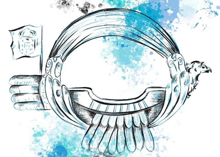
“Well, it was two years ago that I flew, the first time I constructed a balloon it went up in flames, then I made a second balloon which landed on the palace roof, and finally I made a third balloon, which went out through the window of the Casa da Índia, never to be seen again. But did you flu in person or was it only the balloons that flew, Only the balloons but it was just as if I myself had flown”. In the novel “Baltasar and Blimunda”, José Saramago takes us to the 18th century, the times of King John V of Portugal, the construction of the Convent of Mafra and the so called “Flying-Man”, Bartolomeu de Gusmão. Throughout the novel, the author presents the Jesuit priest’s desire to fly and to build a “flying machine”; with the help of Baltasar Sete-Sóis and Blimunda Sete-Luas, he creates his invention, the “Passarola”.
From fiction to facts, many believe that Bartolomeu de Gusmão carried out the first aerostatic experiment in history: at the ambassador’s room of the Palácio da Ribeira, and with King John V attending, he launched a tiny hot-air balloon – which eventually reached “several feet”.
In fact, history is filled with examples of humanity’s desire to reach the skies. From Leonardo da Vinci’s projects (like the Flying Machine, capable of transporting a person) to the famous flight by the Wright Brothers and Alberto Santos-Dumont – who, onboard his 14-bis, carried out the first public flight in Europe, more than four centuries passed.
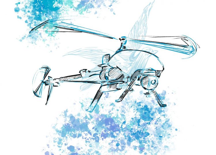
Thanks to technological progress, the airplane became the safest means of transportation; nowadays, we also have access to aircrafts that do not require any crew to fly. We’re talking about Unmanned Aerial Vehicles (UAV). These include autonomous drones or remotely piloted vehicles (RPVS), which can carry out several missions, as we’ll explore in this edition of Spotlight.
Shield Mission: drones supporting the archaeological heritage
According to an Interpol report that gathers information from 72 countries on crimes against cultural heritage, released in 2021, illicit archaeological excavations proliferate around the world, but with a particular focus on conflict zones. As a result, a significant number of pieces end up being smuggled by organised crime groups, undermining the archaeological heritage of the territories.
Asian and South Pacific countries were the ones that reported, in 2020, the largest number of illegal excavations (1563), followed by European (321) and African (153) countries. Interpol’s work suggests that the number of attacks against intellectual property increased during the first year of the pandemic and, in the case of archaeology, may be related to the fact that archaeological and paleontological sites are usually less protected and more exposed to illicit excavations.
Increasing the protection of cultural heritage, defending it from acts of plunder, is the objective of the European project SHIELD – Safeguard Heritage In Endangered Looted Districts, in which INESC TEC participates. As part of this research project, an unmanned aerial system, i.e., drone, is currently being developed to patrol archaeological sites and support the authorities in combating illegal excavations.

According to Hugo Silva, researcher at INESC TEC, most incidents related to looting in archaeological sites happen at night. “We are talking about remote locations, where there is usually no night surveillance”, he stated, adding that, although the technology was mainly designed to be used during the night, it can also be used in daytime scenarios.
“The drone will feature two operation modes. One of the modes will be autonomous, i.e., with automatic take-off and landing ability. Through pre-programmed missions, the drone will perform an hourly patrol flight to provide images and information about what is happening on site. The other mode will include alerts. If the system detects something unusual, it sends this information to a central, which receives the alert and makes decisions based on the data sent by the drone “, explained the researcher.
The idea is for the system to be as autonomous as possible during the monitoring of the occurrences, supporting the decision-making of the authorities during suspicious situations. “It is important to have access to a 3D terrain map that allows us to identify which sites were excavated, in order to understand where the looting is being done”, said Hugo Silva, reinforcing that the system will have the ability to send video images in real time – enabling access to data such as the license plates of the vehicles used by the looters. This way, it will be possible to identify those responsible for the illegal excavations, reach the organised crime networks that smuggle the artefacts, locate the pieces, and recover them.
The aircraft will also be able to move within a radius of five kilometres from its base station, operating wirelessly (with its own communication system), ensuring that all communications between the equipment and the base are not lost.
But, at this point, there is certainly a question: how does the monitoring tasks take place if the vehicle generates noises when moving around? Researcher Hugo Silva claimed that “these are vertical take-off drones, so they are significantly more silent. The flight altitude turns the equipment invisible to the human eye during the night, and that is precisely our goal: invisibility”.
The SHIELD project brings together partners from Cyprus, Italy and Portugal, including a set of end users (in this case, authorities) who may benefit from this solution in the future. In July, the first flight test will be carried out in Cyprus. “We will create a specific scenario, i.e., a real-world event simulation, where people will perform excavations, in order to acquire data that will serve as a basis for the development of artificial intelligence solutions. Artificial intelligence will help to identify the occurrences we aim to monitor. This test flight will also show how everything appears visually, which will be very important to develop the algorithms that will allow the system to become autonomous and start operating”, concluded the researcher.
Rescue mission: drones in response to natural disasters
In addition to the threat posed by human action, archaeological sites can also be affected by climate change, specifically natural disasters. In fact, events such as fires, floods or droughts are increasingly frequent and have a significant impact on the lives of populations around the world. It is estimated that climate change could lead to 200 million people losing their homes over the next two decades, leaving a trail of destruction, injuring people and – in the worst-case scenario – causing many casualties. Regardless of the natural disaster, the priority is to respond quickly and efficiently, saving as many lives as possible.
Hence, the ResponDrone – Situational Awareness System for First Responders project emerges by proposing a drone-supported wireless communication solution that ensures communication between the emergency teams on the ground and the command centre – namely when there are breaks in coverage and the need for capacity building at the disaster site. The solution aims to facilitate the assessment of disaster situations, support decision-making and contribute to the management of operations on the ground.
“In an emergency scenario, there is a lot of difficulties in managing the sources of information and making a quick evaluation of the situation (e.g., how a fire or flood is evolving), because there are no sensors on site that can provide this data; another problem relates to communication”, said Hélder Fontes, INESC TEC researcher, also explaining that, when there is a disaster, the communications infrastructure is affected either because it is overloaded or damaged. “Victims are unable to ask for help and emergency teams are prevented from correctly coordinating the resources they have on the ground”, he stated.
In order to address this question, a private air communication network has been created, which does not depend on other networks and has the ability to adapt as the scenario evolves. “We were able to benefit from connections to remote base stations, which are too far away for users to locate or are blocked by obstacles. Since the drones fly and have a clear line of sight to towers, they can connect and relay data”. As the researcher explained, the system is able to adapt and reposition the connection to areas where the network is being used more extensively.
In addition to facilitating communications, drones are also prepared to carry video cameras, supplies like food, water or medicines, and systems that can detect the cell phones of people who are lost, through the signal they may be emitting. All these activities require the installation of a ground control station, allowing – among other things, and for safety reasons – the navigation of drones from an automatic to a manual scheme.
If, up to now, each vehicle required a control station, the ResponDrone project has made it possible for multiple drones to use a single station. “The project also explored the use of a control station by up to three drones, but we believe this amount could increase”, said Hélder Fontes, adding that one of the concerns was the creation of a software of interfaces capable of supporting any type of drone. This way, and concerning mission contexts, it’s possible to have drones carrying out different tasks: one aircraft could broadcast videos while another could deliver supplies, thus contributing to the efficient coordination of civil protection tasks.
The project also features other innovative aspects: “we were able to integrate the drones’ operationalisation with the remaining air traffic. There is an air traffic controller that manages the drone missions together with other aircrafts that may be operating in the region. We focused on developing a safe network integrated with the current air control process, thus preventing collisions”. The researcher also said that this system, knowing that there are people in the area where the drone is operating, reprograms the routes to avoid any danger to people on the ground in case the vehicle falls. All this thanks to the ability to collect and broadcast video, resorting to artificial intelligence that enables georeferencing and the detection of people, vehicles, fires or even floods, automatically and in real-time.
“Access to this system is made through a web interface, where it is possible to create and monitor missions and access the video collected, the area covered by communications, the location of people or buildings”. According to the researcher, an android application was also developed, so that people working in the field have access to a simplified version of the system, with specific features: chat, sending coordinates or controlling the angle of the drones’ video camera. Real-time access to the situation will provide a comprehensive overview of the disaster and a faster response.
The RESPONDRONE project is funded by Korea and the European Union and brings together 20 partners from Germany, Israel, Spain, France, Korea, the Netherlands, Latvia, Armenia, Greece, Bulgaria, Portugal, and Belgium. The technology developed within the scope of the project is expected to enter the market within a year, in order to support civil protection teams.
The SHIELD and ResponDrone projects are some examples of the use and potential of unmanned aerial vehicles. We know that, in the past, many dreamt about flying; we’re now sure that they did not dream in vain. Thanks to the evolution of science and technology, we now have autonomous solutions that can save lives. Should we be taking off towards the future?
The researchers mentioned in this news piece are associated with INESC TEC.

 News, current topics, curiosities and so much more about INESC TEC and its community!